The International Gravity Field Service – IGFS
IGFS is a unified “umbrella” IAG service, which: (i) Coordinates collection, validation, archiving and dissemination of gravity field related data (ii) Coordinates courses, information materials and general public outreach relating to the earth’s gravity field, (iii) Unifies gravity products for the needs of GGOS – the Global Geodetic Observing System.
IGFS coordinates the servicing of the geodetic and geophysical community with gravity field-related data, software and information. The combined data of the IGFS entities data include both satellite-derived and combined global models, potential values at IHRF sites, time-variable gravity models, terrestrial, airborne, satellite and marine gravity observations, earth tide data, GPS leveling data, digital models of terrain and bathymetry, ocean gravity field and geoid from satellite altimetry.
IGFS Data and Products
IGFS collects through its services gravity, geoid, potential, GEM, COST-G, DEM, SG raw, and tidal products for use in a wide range of geodetic, geophysical, and oceanographic works. These datasets are used by the geodetic community and the IGFS services members, SGs, JWGs, to generate the data products which are made available to interested users through this website.
Moreover, IGFS has developed and provides online applications for the creation of metadata for gravity and geoid data. Human readable formats are available as well as search functions.
Gravity and geoid metadata
Online applications for the creation of metadata for gravity and geoid data. Service for searching the metadata database.
Gravity data
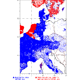
Land, marine, airborne gravity data as point and gridded values. Absolute and relative gracity data, WGM
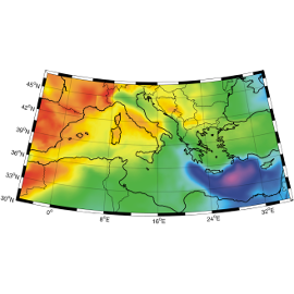
Geoid
Geoid models and geoid determination software, geoid modeling processing methodologies
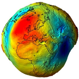
Global Earth Models
Collection and archive of all existing global gravity field models, web interface for access to GEMs, model visualization and service.
Time-variable GEMs
Combined gravity field solutions in SH coefficients and spatial grids for hydrological, oceanic and polar ice sheets applications.

DEM data
Digital Elevation Models, relevant software for DEM creation, assessment, manipulation and display, global relief and crustal models and spherical harmonic data sets.
SG and Earth tide data
Temporal variations of the Earth gravity field through long-term records from ground gravimeters, SG data, Earth tide data.
IHRF data
Potential values at IHRF sites from the realization of the IHRF